
Guides & videos
Compass — find a point, hold a bearing
In short: the Compass records nothing. It takes you back to what you have already recorded — or helps you hold a direction. It is the module you open when you are looking for something.
Two uses:
- reach a grid point — a measurement spot placed in a parcel from Mapping;
- follow a bearing: a ride to open, a sampling line, a marking direction.
A compass that changes face
Forest Assist switches on its own between two displays, depending on how you hold your iPhone:
| You hold the iPhone… | You get |
|---|---|
| flat, in your palm, like a pocket compass | the rotating map |
| upright, in front of you, like a sight | the camera sight |
There is no button to switch from one to the other: you change your grip, the screen follows. A tolerance zone keeps the display from jumping when you hold the device at an angle.
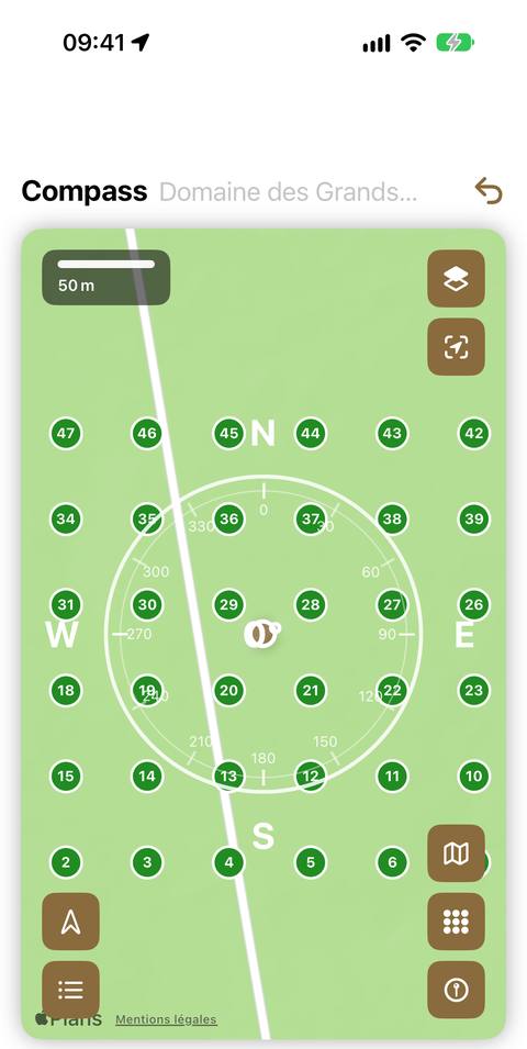
Flat — the rotating map
At the top of the screen, next to the title, the app shows the name of the parcel you are in, when it recognises one. So you always know where you are.
The compass rose surrounds the map. The available controls:
| Control | Effect |
|---|---|
| Fixed / Mobile | the map stays north-up, or turns with you |
| Show parcels | overlays your parcels on the map |
| Show grid | shows the grid points of the active domain, numbered; the targeted point is in red (shown by default) |
| Show observations | overlays your observations, one symbol and one colour per type |
| Recenter | returns to your position without changing your zoom level |
| Map style | Map or Satellite |
A scale at the bottom of the map gives you real distances.
Upright — the camera sight
The camera image is displayed, with a reticle and a target marker. Walk forward keeping the marker centred: you are heading the right way.
The screen constantly shows the remaining distance to your target. An adjustable zoom lets you aim at a distant point.
The app also guides you by voice (VoiceOver): "Turn slightly right to align the marker."
Choose what you are looking for
Tap the Target button to choose your target:
A grid point
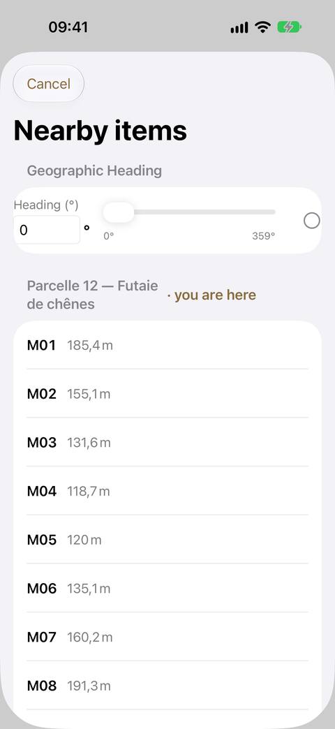
The Nearby items list offers you the grid points within 200 m of you, grouped by parcel: the parcel you are in comes first ("· you are here"), the others follow in alphabetical order. Within each parcel, the points are sorted by number — M01, M02…, the walking order — with their distance.
Select one: the app constantly shows its direction and your distance to it, and its code (M01) on the map.
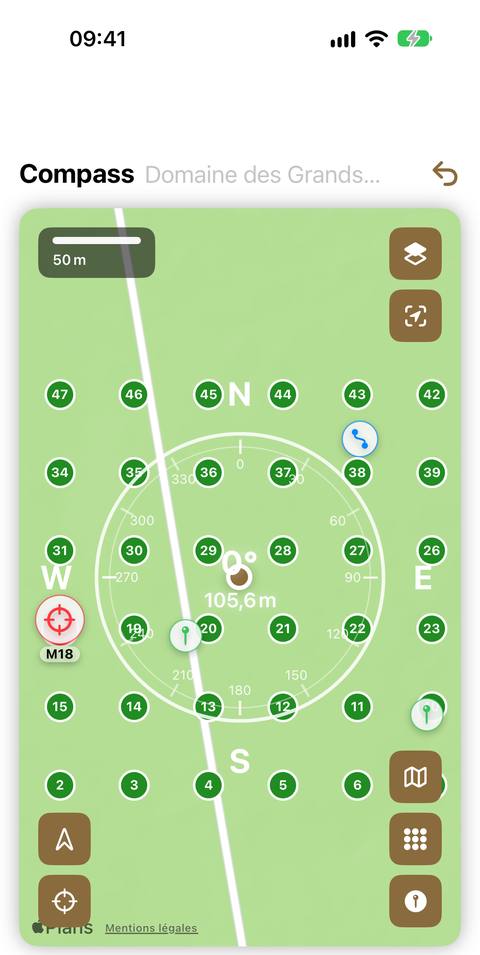
This is the main use: reaching your sample plots one by one, under canopy, where GPS alone is not enough.
If the list is empty, the app tells you why: no grid in this domain (create one from Mapping), the phone's position not known yet, or no point within 200 m.
A geographic heading
Enter a value with the keyboard or the slider: the app guides you along that direction, without a distance (you are following a line, not a point).
The Remove Heading button clears the current target.
Degrees or gradians?
Many foresters work in gradians (400 for a full turn) rather than degrees. You choose in Settings ▸ Compass ▸ Angle unit, and the choice applies everywhere: compass, inventory azimuths, measuring tools.
Adjust readability
A white reticle disappears against a winter sky; a dark reticle gets lost under canopy. A single colour is set in Settings ▸ Appearance ▸ Overlay color: it applies to the rotating map, the sight and the reticle — and also to the basal area reticle.
Good to know
- Calibration: if the heading looks wrong, draw a figure eight with your iPhone, arm outstretched. This is the standard iOS magnetometer calibration.
- Under a power line, next to a metal fence or inside a vehicle, the heading is disturbed. Move a few metres away.
- The parcels layer shows those of all your domains, not just the active one: on the move, you also see the neighbouring properties you have entered.
- The list only offers the points of the active domain; change domain in the banner to target elsewhere.
- The list is calculated when it opens: as you walk, close it and open it again to see the points that have come within the 200 m radius.
- The module never changes your data: it only reads it.